by Curt Remington | Feb 3, 2026 | Nature, Trip Reports
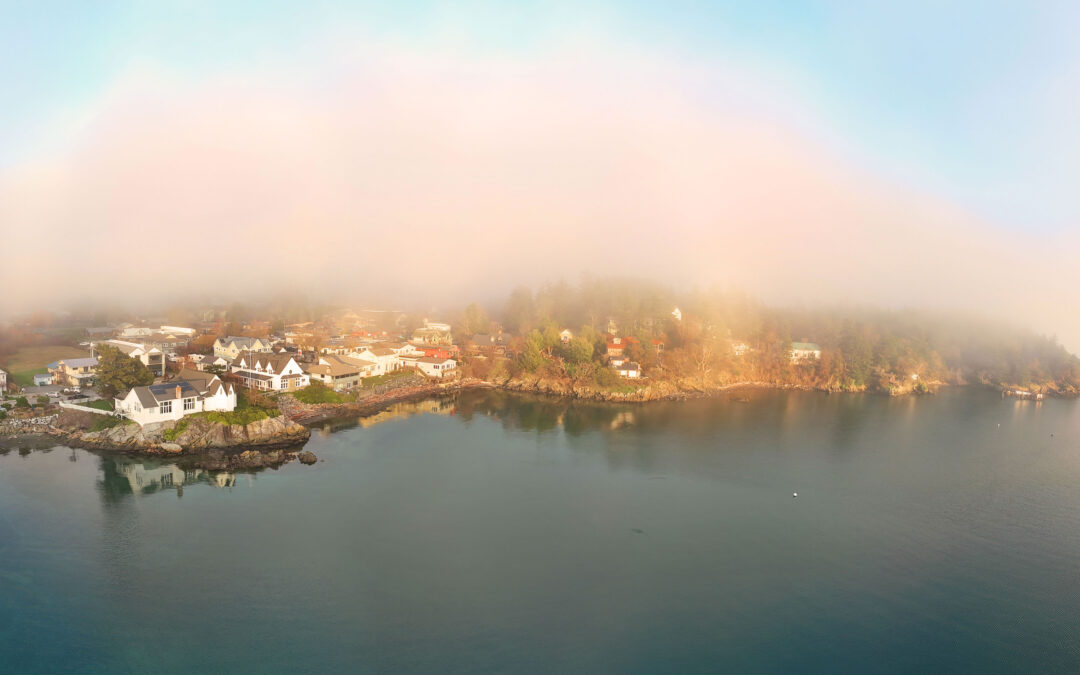
Orcas Island, the largest of the San Juan Islands, makes a perfect weekend getaway. Not only is it the biggest island, it’s also the highest—home to Mount Constitution (2,409 feet)—and it contains Washington’s largest state park, Moran State Park. Orcas is our...
by Curt Remington | Sep 19, 2025 | Trip Reports
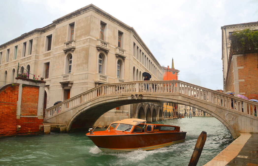
Venice, Italy Venice, Italy is like nowhere else I’ve ever been. Built on more than 100 islands, the city is a maze of canals and bridges — over 400 of them. No cars, no buses. People and goods move by boat, or on foot. The entire place feels like a dream set in stone...
by Curt Remington | Apr 8, 2018 | Meditation, Nature, Photography, Public Speaking, Trip Reports
Kauai, the Garden Island, is a wonderful vacation destination for nature lovers. As absolute lovers of nature, my wife Mary and I had contemplated a trip to Kauai for years. Somehow, we managed to visit all the other major islands first (Maui, the Big Island and Oahu)...
by Curt Remington | Jan 28, 2018 | Meditation, Nature, Photography, Trip Reports
For a profoundly satisfying experience, venture deep into nature and immerse yourself in her solitude. ~Curt Remington The above words came to me while writing a speech about our trip to Desolation Sound. In this blog, my goal is to share our trip with you and to...
by Curt Remington | Jul 6, 2015 | Trip Reports
Destinations: Washington’s Ross Lake and Clark Island in the Salish Sea Can you sea kayak on a lake? In order to answer that challenging question, I signed up for two trips with the Whatcom Association of Kayak Enthusiasts (WAKE), one on Ross Lake and the other to...